| Habitat | Acres | Miles | Feet |
|---|---|---|---|
| Acquisitions/Easements | 0.50 | 0.00 | 0.00 |
| TOTAL | 0.50 | 0.00 | 0.00 |
Basic Project Information
City/Town/Village
Westport
County
Fairfield
Site Name
Sherwood Millpond
Habitat Types
Completed
Project Urls
Photo Gallery
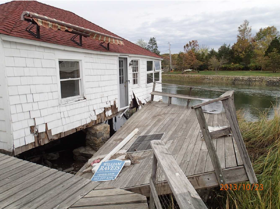
View of one of the Sandy-damaged homes prior to acquisition and removal. Photo credit: Town of Westport.
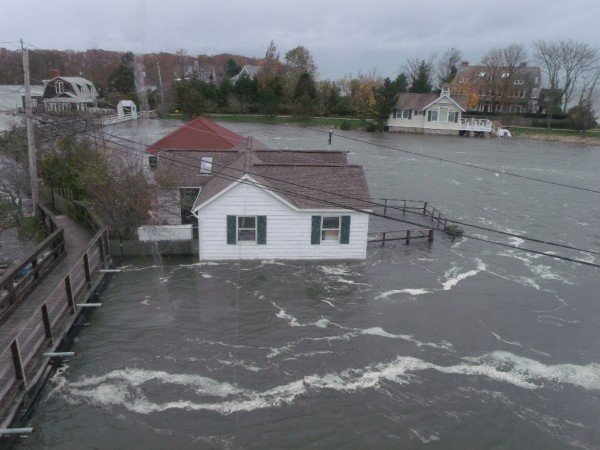
Oblique view of 38 & 40 Old Mill Road during Hurricane Sandy, October 29, 2012. Photo credit: Town of Westport.
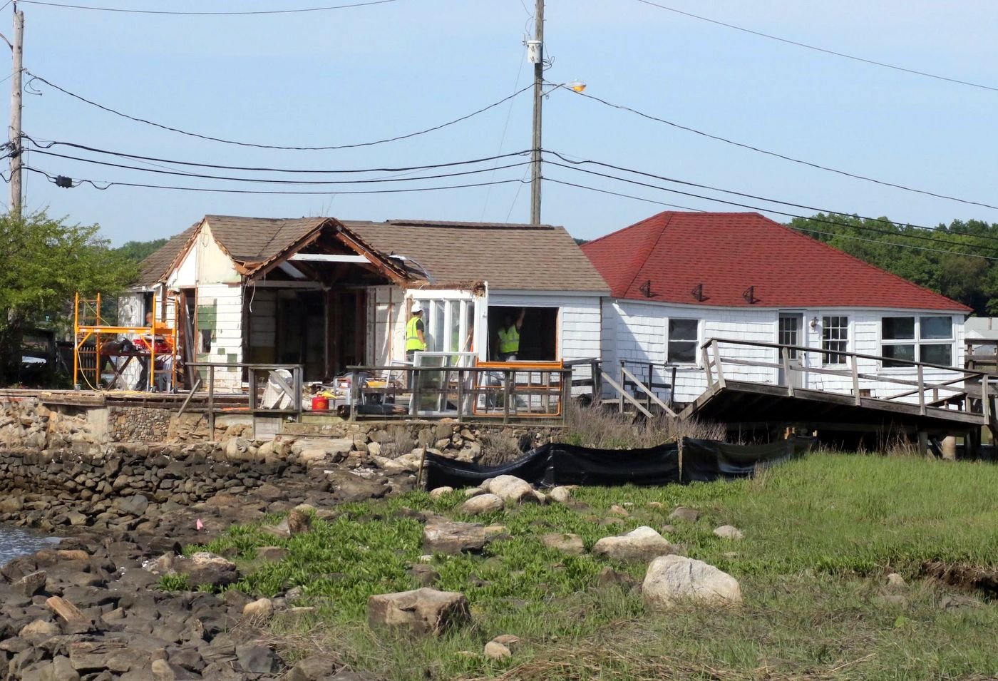
38 & 40 Old Mill Rd undergoing careful demolition. Debris had to be cut up using hand tools and carried off site to an awaiting dump truck, since the properties were inaccessible to heavy equipment. Photo credit: Town of Westport.
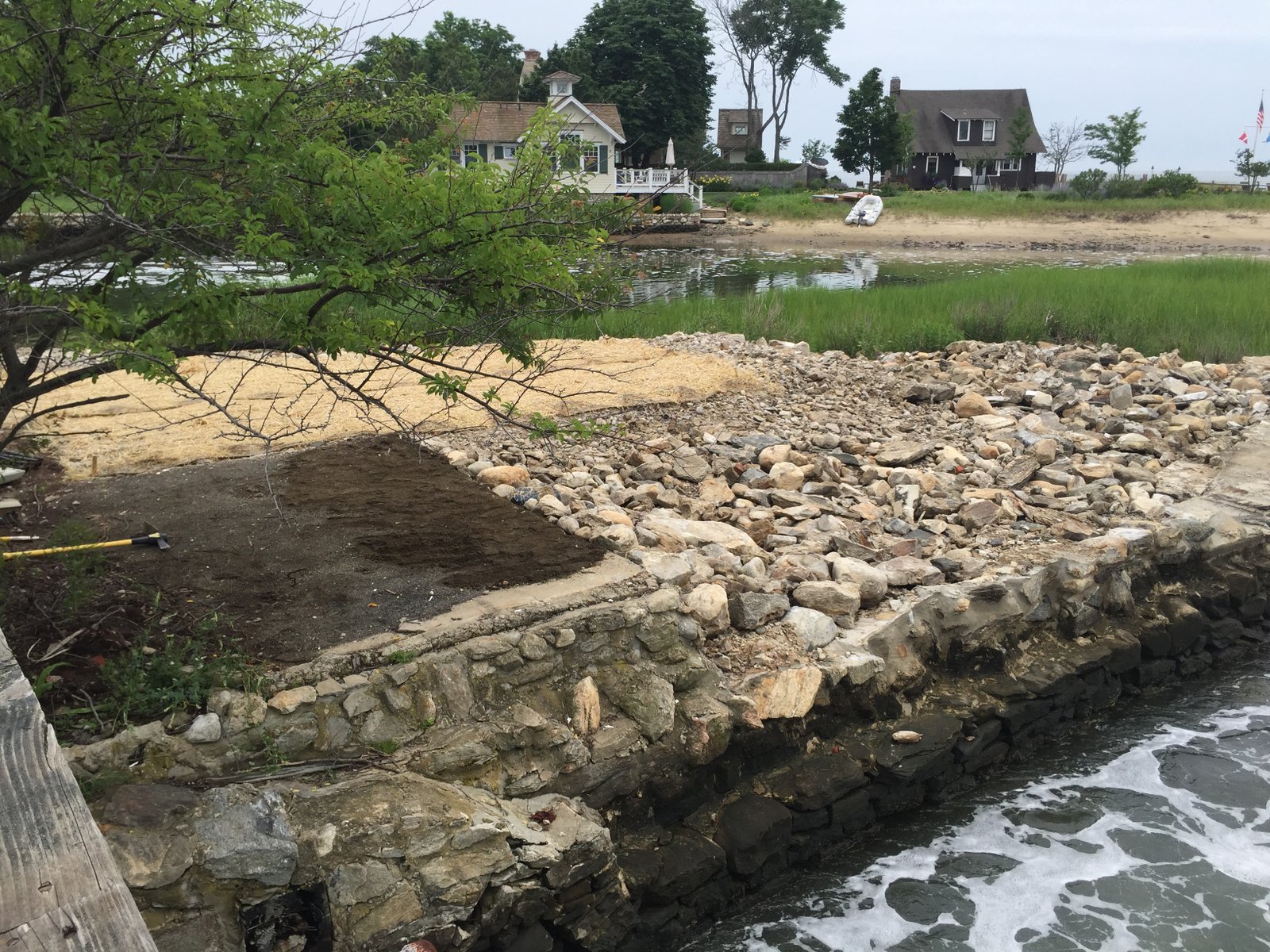
View of 38 & 40 Old Mill Rd upon completion of demolition. Photo credit: Town of Westport.
Funding
Funding Sources
| Funding Organization | Funding Program | NFWF-LISFF Funded Amount | Amount Awarded | Amount Spent |
|---|---|---|---|---|
| Federal Emergency Management Agency (FEMA) | ||||
| Town of Westport |
Specific Project Information
Project Partners
Partners Organization
Town of Westport
Partners Organization
Federal Emergency Management Agency (FEMA)
Cause of Degradation
Development Encroachment
Fill - Other
Grading
Seawall at Tidal/Upland Border
Degradation Description
A pair of summer cottages was built on a small marsh island in the narrow channel between Sherwood Millpond and Compo Cove, in Westport, CT. Construction involved filling of tidal wetlands to raise the ground level, as well as armoring the shoreline with boulders and seawalls
Project Description
The 2 homes have a combined footprint of approximately 1700sqft, including the attached decks. They date back to 1900 and 1920, and quite surprisingly survived many storms, given their extremely high-risk location. They were finally damaged beyond repair by Hurricane Sandy in October 2012, and the owners decided to sell their properties to the Town of Westport for conservation purposes. The Town was able to acquire the properties, demolish the homes, and clean up the site thanks to a grant by the Federal Emergency Management Administration. The Town is allowing the property to return to a natural state and restricting access to the site for the next year or two. The properties will be maintained in perpetuity as open space for the conservation of natural floodplain functions and restricted from use or development that interferes with this purpose.
Restoration Technique
Cottage / Home / Structure removal
Excavation
Fill Removal
Land Acquisition
Waterbody
Compo Cove
Mill Creek
Sherwood Millpond